
The Bureau of Land Management has released a draft travel plan for a 76,000-acre region in southern Carbon County that’s popular with motorcyclists as well as hikers. The Cottonwood/Weatherman Draw Travel Management Area sits just north of the Wyoming border and between the Beartooth and Pryor mountain ranges. The high desert area contains a 12,000-acre Area of Critical Environmental Concern that has one of the highest concentrations of pictographs and petroglyphs in North America.
By the BLM’s estimate, there may be 600 cultural sites spread across the entire landscape. Opposite this region is a popular motorcycle riding area where an annual event is held. In addition, the lands are open to oil and gas exploration and livestock grazing. The BLM tried to take a middle-of the-road approach in favoring its Alternative D. Although 26 miles of routes would be closed to motorized vehicles, a new 10.5-mile road would be constructed. You can check out the plan online at https://eplanning.blm.gov/eplanning-ui/project/2026973/570 or read through my story for some highlights at Billings Gazette.
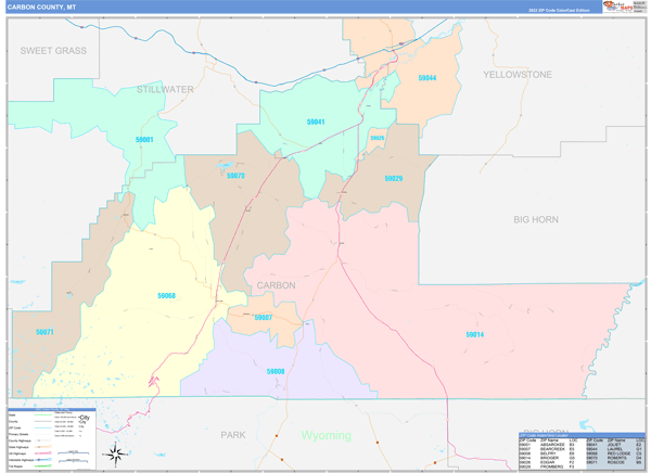
BLM unveils travel plan for southern Carbon County

Latest Montana Hunting & Fishing Articles

MT Waterfowl Hunting
2025-2026 Non-Member Waterfowl & Upland Game Bird Hunting Draft Proposal
Your chance to shape the future of hunting on the Flathead Reservation—share your thoughts on the 2025-2026 draft regulations…
The Department of Livestock Asks Montanans to be Aware of Avian Influenza
A Canada goose was confirmed infected in Gallatin County on February 26.
Get Your Goose on With the Ultimate Goose Jerky Recipe
It’s time to get your goose jerky on!
Trump Jr. Faces International Duck Poaching Probe
Donald Trump Jr.’s hunting trip in Italy just went from a wild adventure to a legal quagmire after he allegedly poached a rare duck—now, the hunt is on for answers.
Montana Hunting
A Once-in-a-Lifetime Buck at 98
At 98 years old, he didn’t just make a great shot—he made history…
Elk and Deer Permit Drawing Results Are In
Montana’s big game permit results are in—time to find out if you’re chasing dreams this fall or chasing leftovers….
Spring Black Bear and Spring Turkey Seasons Open Today, April 15
Spring Black Bear and Spring Turkey Seasons Open Today!
Kalispell man found guilty on seven criminal counts related to poaching crimes
Carr was convicted of two counts of unlawful possession of wildlife, two counts of hunting or killing an overlimit of game animals, two counts of waste of game animals, and a single count of loan or transfer of a license.
BLM reminds recreational shooters to prioritize safety and fire prevention on public lands
With warmer spring weather drawing more people outdoors, the Bureau of Land Management is reminding the public to follow safe and responsible shooting practices on BLM-managed lands in Montana, North Dakota and South Dakota.
When You Know You Raised ’em Right
When you know you’re doing a good job raising your little one as a sportsman, you just know….
Annual survey shows increase in gray wolf packs in Washington, decrease in overall minimum wolf count
As of Dec. 31, 2024, WDFW and partnering tribes counted 230 wolves (a 9% decrease from 2023) in 43 packs in Washington.
Montana Fishing Reports
Jan’s Fishing Report for the Week of April 15, 2025
Spring 2025 has the Yellowstone flowing with color, the spring creeks buzzing with baetis, and hungry trout snapping out of their winter slumber—just in time for some seriously good fishing…..
Don Wilkins’ Weekly Fort Peck Fishing Report 4.17.25
Big walleye, hungry eaters, and bonus pike—Lake Peck’s dam area is heating up even if the water temps aren’t!
Kootenai River Fishing Report 4.15.25
Spring’s heating up, but the Kootenai’s still chill—midday hatches, tight drifts, and streamer thumps are the name of the game…
Montana Ice Fishing
When Ice Fishing Becomes a Rescue Mission
A peaceful day of ice fishing shattered in an instant…
Chasing Ice: For Some, the Season’s Over
Some anglers are stuck dreaming of frozen lakes, while others are packing their gear and chasing the last ice—where do you stand?
LAST ICE HEIST!!!
As Canyon Ferry’s ice fades fast, one last thrilling ice fishing adventure delivers big trout and bigger lessons—before the season slips away! More from Montana Grant here!
ICE DOESN’T CARE!!!
As Montana’s late-season ice thins and conditions become unpredictable, anglers are urged to stay cautious—no fish is worth the risk.
FWP’s Helena Area Reservoirs Fishing Report 3.10.25
Ice conditions are unpredictable, but for those willing to take precautions, the fishing has been excellent across Helena area waters.

Montana Outdoor Podcast
MT Outdoor Podcast: The History and Effects of the Introduction of the Cisco into Fort Peck Reservoir
What do deep-water monsters and a double bacon cheeseburger have in common? Tune in to the Montana Outdoor Podcast to find out…
Sponsors:
MT Outdoor Podcast: Casting Lines and Relationship Goals with the Goodmans
What do you get when a seasoned angler takes his date fishing, forgets to mention the eel-like fish might hug her arm, and somehow still ends up married? Hook into this MT Outdoor Podcast episode to hear it all!
MT Outdoor Podcast Exclusive Sneak Peek: The Couple That Fishes Together…
Get ready to fall hook, line, and sinker for this feel-good sneak peek—love, laughs, and a wild first date with a fish that hugs back…
MT Outdoor Podcast: Shaun Jeszenka of Frontier Anglers in Dillon Shares the Fishing Secrets of Southwest Montana
Ready for the ultimate fly fishing adventure? Tune in to the Montana Outdoor Podcast as Shaun Jeszenka reveals how you can catch six trout species in one day across Southwest Montana’s legendary waters!
Sneak Peek Alert: Chasing Trout & Dreams with Shaun Jeszenka
Ever wondered how to catch six different trout species in a single day? Tune in for this exclusive MT Outdoor Podcast sneak peek of insider tips from the legendary Shaun Jeszenka of Frontier Anglers…
Outdoor How-To
How To Win the Recall Battle with Your Dog
Tired of playing keep-away with your dog while you’re at hunting camp, fishing, on the trapline or hunting? Even well-trained dogs have their moments! Learn the secret to achieving total recall—no chasing required!
A Feud Over Filleting Has The Internet Debating the ‘Right’ Way to Clean a Pike
When it comes to filleting a northern pike, the internet has spoken—and, as usual, everybody is right and wrong, simultaneously….
How To Master the Art of Finding Antlers
Whether it’s sharp eyes, pure skill, or just a dog with a better nose, shed hunting success is up for debate—but this video might just tip the odds in your favor…
MT Wildlife
Bobcat Claws and Chaos
Forget Netflix thrillers—this bobcat vs. squirrel showdown has better stunts and zero CGI….
Turkey Lurkey
Before the Bald Eagle soared into the spotlight, the wild turkey almost strutted away with the title of America’s national bird—and after reading this, you just might agree Ben Franklin wasn’t so crazy. More from Montana Grant here…
Love Might Have a Price Tag for Rams
Turns out love could be blind and concussed for rams in the bighorn sheep world…
Montana Tourney Trail
2025 Spring Mack Days – Week 5 Update
Thousands of fish, millions of memories, and one elusive $10,000 trout—Mack Days is in full swing….
Viral Stories
In 1916 They Blew Up A Yellowstone Grizzly Bear with Dynamite After it Killed A Man
In 1916, Yellowstone National Park recorded its first officially documented fatal grizzly bear attack. The victim, Frank Welch, a 61-year-old […]
Irish Woman Sues Wyoming Dude Ranch After Bear Spray Incident Leaves Her Injured
An Irish woman, Lorraine Learmont, has filed a lawsuit against the Triangle C Ranch near Dubois, Wyoming, following an incident […]
Watch This Elk Play a Friendly Game of Backyard Soccer
This smart and friendly elk has serious footwork when it comes to soccer.
Montana FWP
Elk and Deer Permit Drawing Results Are In
Montana’s big game permit results are in—time to find out if you’re chasing dreams this fall or chasing leftovers….
Spring Black Bear and Spring Turkey Seasons Open Today, April 15
Spring Black Bear and Spring Turkey Seasons Open Today!
Wild Game Recipes
Cooking with Kokanee Quinn: Walleye Wings
Kokanee Quinn found a recipe that even has the chef’s fish-hating wife going back for seconds….
Wild Turkey Biscuits and Gravy Recipe
Wake up and smell the gravy…and wild turkey!