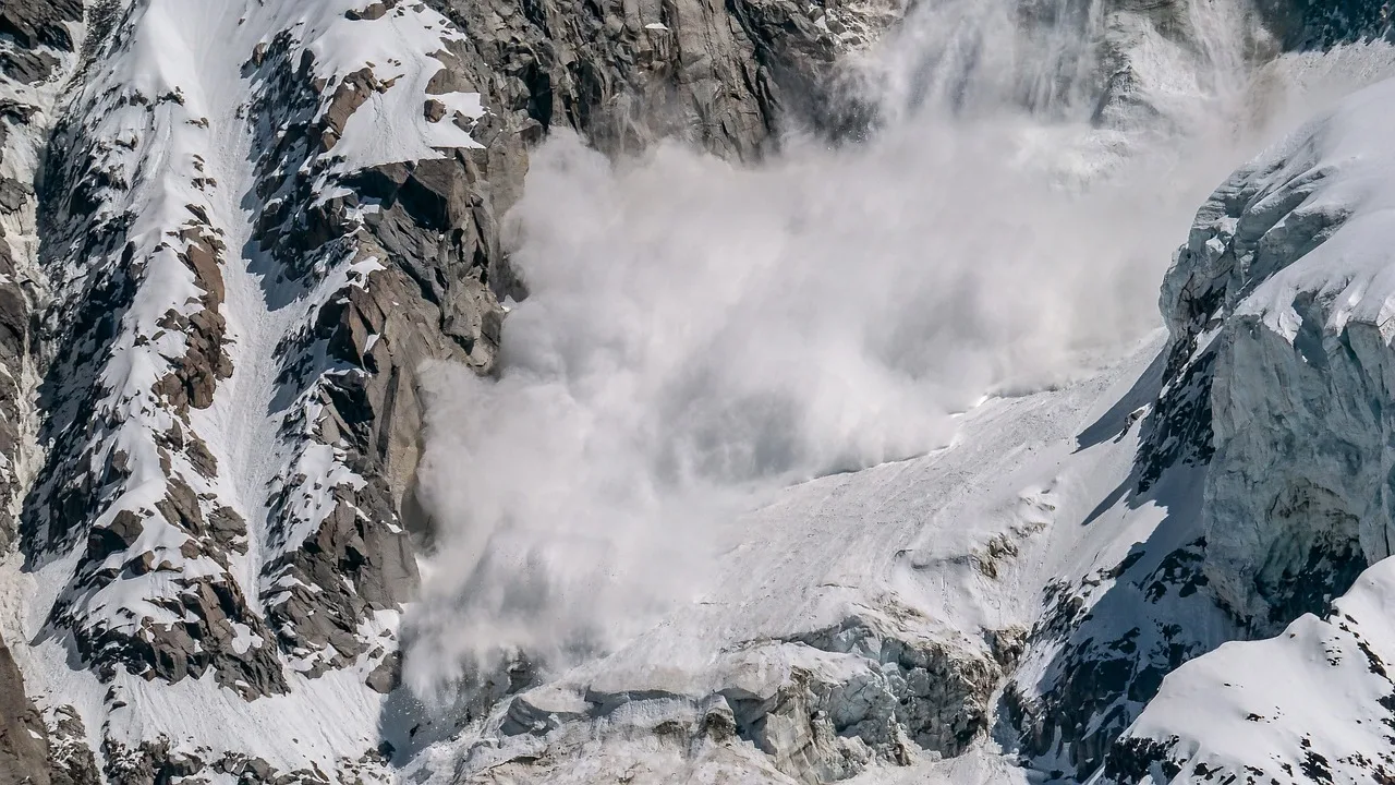
From the Flathead Avalanche Center:
Very dangerous avalanche conditions are developing as a storm brings rain, heavy snowfall, and strong winds to the forecast region.
When
In effect from Sun, Feb 23, 2025 – 6:00AM to Mon, Feb 24, 2025 – 6:00AM
Where
The Whitefish, Apgar, Swan, and Flathead mountain ranges, and portions of Glacier National Park (the McDonald Valley and peaks near Marias Pass).
Impacts
Wet snow avalanches are likely below about 6000 feet. Above that elevation, large to very large natural and triggered avalanches are likely; these could involve 1 to 2 feet of new and drifted snow or break deeper in the snowpack, on buried weak layers. Avalanches may run long distances, into lower-angled terrain, valley floors, and snowmobile trails. Small slopes like roadcuts and snow-covered roofs may be hazardous.
Precautionary/Preparedness Actions
Widespread and complex avalanche hazards. Travel in avalanche terrain is not recommended.
From the Idaho Panhandle Avalanche Center:
An Avalanche Warning is in effect from Sunday 6 AM to Monday 6 AM. Very dangerous avalanche conditions have developed from wet, dense snowfall and moderate to heavy rain saturating the snowpack and will last through Monday morning. You can very easily trigger avalanches large enough to bury or kill you, and some will release spontaneously. Avoid travel in avalanche terrain during this period.
When
In effect from Sun, Feb 23, 2025 – 6:00AM to Mon, Feb 24, 2025 – 6:00AM
Where
The Selkirk, West and East Cabinet, Purcell, and Bitterroot Mountains – Silver Valley above 4,000 feet.
Impacts
The combination of dense storm snow, strong winds, and continued moderate to heavy rainfall saturating the upper snowpack is overloading buried weak snow layers. The snow line will likely rise to between 6,000 and 7,000 feet Sunday afternoon-evening. It will be very likely for backcountry travelers to trigger large to very large avalanches and natural avalanches are likely. Avalanches can break wide across terrain features and run long distances to lower elevations and into mature forests.
Precautionary/Preparedness Actions
Travel in avalanche terrain is not recommended during this period.
From the West Central Avalanche Center:
Avalanche danger will rise to high today with a significant rain on snow event.
When
In effect from Sun, Feb 23, 2025 – 6:48AM to Mon, Feb 24, 2025 – 6:48AM
Where
The Bitterroot mountains from Lost Trail Pass to Lolo Pass, the Rattlesnake, and the Seeley Lake area.
Impacts
Rain falling on snow at all elevations and rapid warming will lead to dangerous avalanche conditions.
Precautionary/Preparedness Actions
Very dangerous avalanche conditions. Travel in avalanche terrain is not recommended. Avalanches may run long distances and can run into mature forests, valley floors, or flat terrain.